Japoniæ insulæ, The mapping of Japan: Historical Introduction and Cartobibliograhy of European Maps
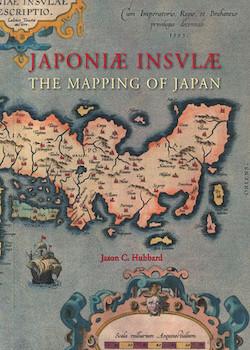
Japoniæ insulæ, The mapping of Japan: Historical Introduction and Cartobibliograhy of European Printed Maps of Japan to 1800
By Jason C. Hubbard
Houten: Hes & De Graaf, Publishers BV
2012, 444 pages with 374 colour illustrations, ISBN 978-90-6194-531-4
Review by Sir Hugh Cortazzi
“The purpose of this work has been to identify and classify all known printed single-sheet maps and charts concentrating on the Japanese islands, and first issued in Europe before the year 1800” declares Jason Hubbard. He has identified 125 main maps of Japan and includes illustrations of every one. He also lists their subsequent issues and notes any alterations made.
This work can be regarded as the definitive study of European printed maps of Japan. It will be an invaluable tool for scholars, collectors and dealers. It reflects the result of years of intensive study and pertinacious research.
The principal reference for Hubbard’s study was a monograph by Tony Campbell published in 1967 for the Map Collectors’ Circle. In 1990, Campbell cooperated with Lutz Walter in the compilation of A Cartographic Vision of Japan. My earlier book Isles of Gold, Antique Maps of Japan which also acknowledged a debt to Tony Campbell was published in 1983. It concentrated on the mutual influence of Japanese maps of Japan and European maps of Japan as well as on Japanese maps as art objects.
Hubbard’s objective was, he explains, to try to answer such questions about maps of Japan as: “What was their origin? Who had engraved them? To what atlas or travel account did they belong? Could a map be precisely dated? Why were the maps so different (and some almost identical)?” He has found most of the answers to these questions.
The book starts with a “typology of the early depictions of Japan” including some fanciful shapes deriving from legend and imagination before the arrival of the first Europeans in Japan in 1543. The first printed ‘map’ of Japan or Ciampagu appeared in a book published in Venice in 1528. Various other fantastic depictions were used in other sixteenth-century atlases. The first map, which bore any resemblance to reality, was that produced by Ludoico Teisera, which was published in the atlas of Abraham Ortelius in 1595 entitled ‘Iaponiae Insulae Descriptio.’
Hubbard in his scholarly and lengthy introduction of 125 pages to the cartobibliography covers in detail the development of the cartography of Japan. In discussing the early stages of map-making in Japan he describes Jesuit influences. He outlines the changes introduced in the seventeenth and eighteenth centuries and the increasing influence of Japanese maps on western depictions of Japan. As Japanese mapmakers did not use the same techniques as western cartographers this often led to further inaccuracies in western maps.
In a separate section on piracy and counterfeits, Hubbard concludes that the majority of the books containing maps of Japan were “either pirated, or more rarely, counterfeited. The majority of published maps are also a result of copying, not always crediting the original author.”
A further section is devoted to early Japanese mapmaking which dates back to the seventh century. The ‘father’ of Japanese cartography is reputed to have been a Buddhist priest called Gyôki or Gyôgi.
Hubbard also includes an informative section by Wolfgang Michel about Japanese names on early modern Western maps of Japan. This should help collectors and students to identify places marked in Roman letters on early maps of Japan, although some names have been so corrupted that they defy identification.
This detailed book even includes a paragraph about the mapping of the uninhabited Senkaku islands which are claimed by both Japan and China and are currently the subject of an acrimonious dispute.
Japoniæ insulæ is a fascinating and comprehensive work of interest and value to all interested in the cartography of Japan.